In the era of artificial intelligence (AI) and big data, the amalgamation of spatial data science and AI has emerged as a potent force, unlocking a new frontier of insight into the world around us. Combining the power of AI algorithms with spatial data analysis techniques, this interdisciplinary field offers unprecedented opportunities for understanding complex spatial relationships and making data-driven decisions. But what exactly is spatial data science using AI, and how is it reshaping our understanding of the world?

Showing posts with label Visualization. Show all posts
Showing posts with label Visualization. Show all posts
Boosting Interest in News Articles with Maps: A Strategic Guide

In today's digital landscape, capturing and retaining audience interest in news articles requires innovative approaches. One effective strategy that can significantly enhance engagement is incorporating interactive maps into news content. By integrating maps, journalists can provide visual context, enhance storytelling, and offer a unique perspective that resonates with readers. In this article, we'll explore how news publishers can leverage maps to increase interest in their articles and drive higher engagement.
Why Use Maps in News Articles?
Syndicated Maps: Revolutionizing Crowdsourced Mapping for Public Safety
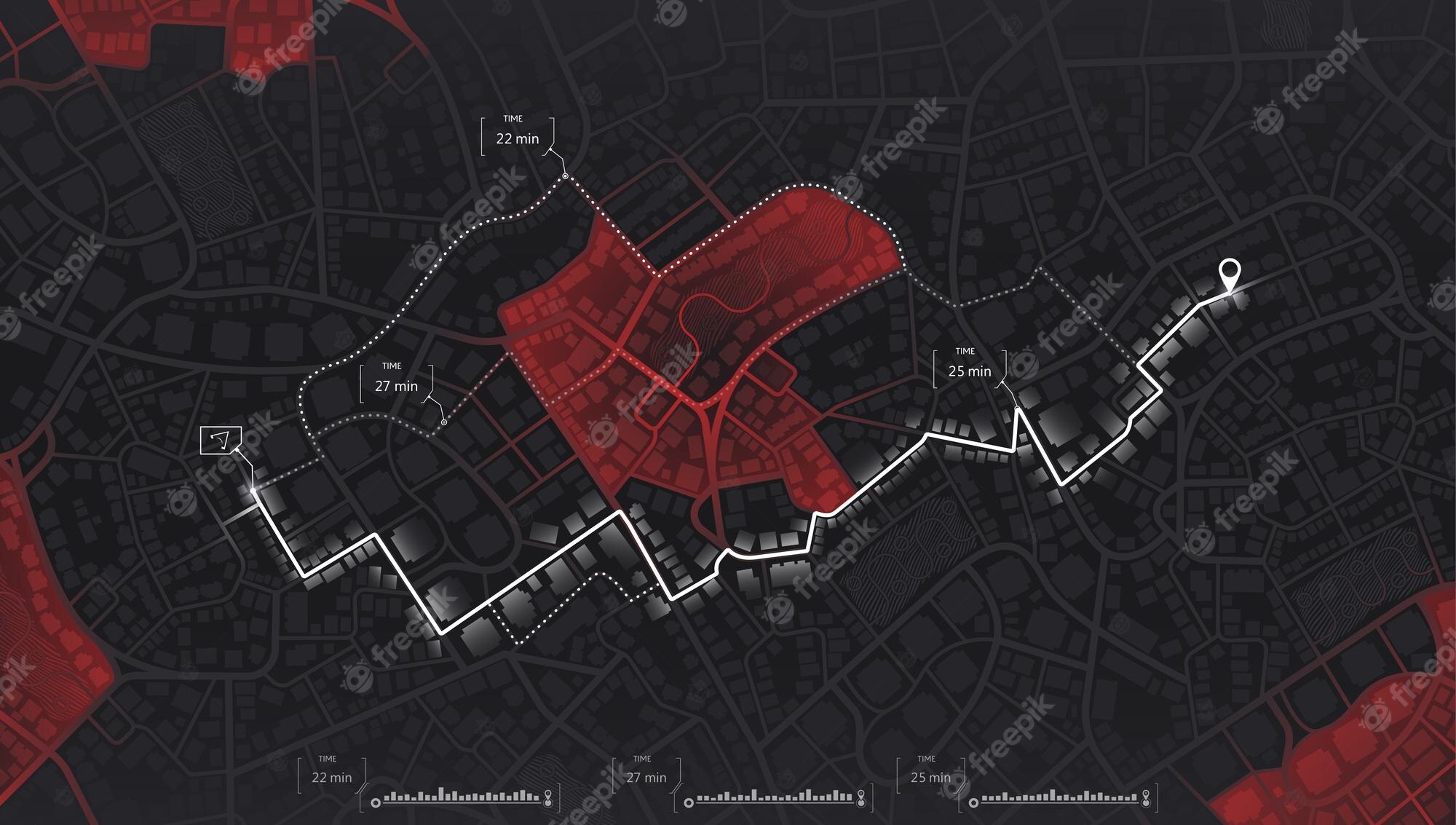
In today's digital age, the power of crowd collaboration and data visualization has unlocked new possibilities for solving complex social, business, and political issues. Syndicated Maps, a mapping services development firm based in Manhattan Beach, California, is at the forefront of this revolution. With its innovative crowdsourced map databases, Syndicated Maps aims to provide a visual platform that helps users discover and tackle various problems related to public safety. In this article, we will explore the groundbreaking work of Syndicated Maps, its mission, and the diverse maps it offers to empower individuals, businesses, and governments in creating healthier and safer communities.

Musical Maps Are Amazing: 10 Steps To Make Musical MIDI Art
World Map of Music
Creating musical MIDI art involves combining music and visual art in a way that produces visually appealing images or patterns when viewed as MIDI data. MIDI art is a creative and artistic endeavor that requires some familiarity with music composition and MIDI editing software. Here are the general steps to make musical MIDI art:
Google Shutting Down Fusion Tables is a Huge Mistake

Reasons Why Google Shutting Fusion Tables is a Huge Mistake
Popular Articles (All Time)
-
In the evolving landscape of digital media, publishers are constantly seeking innovative ways to monetize their content. One such tool that...
-
 By Emily Cohn (Age 10) Are paper straws better for our environment than plastic straws? What do paper straws do in the world?
 -
Credit card fraud has been a persistent issue for decades, affecting millions of people worldwide. Despite significant advancements in tech...
-
Geographic Information System (GIS) visualization techniques are essential for analyzing and presenting spatial data in meaningful ways. Her...
-
A Great Depression By 2025? - The Man Who Called The 2008 Recession Sounds The Alarm | Peter Schiff
-
Steve Blank shares an insider's perspective on how data and analytics are disrupting the art of venture capital investing . Is the era...
-
As we progress through 2024, the global financial landscape presents numerous opportunities for savvy investors, particularly in the realm...
-
When someone agrees to become a successor trustee , they often underestimate the commitment required. Acting as a trustee is not merely an ...


